Pensacola Discussion Forum
Would you like to react to this message? Create an account in a few clicks or log in to continue.

This is a forum based out of Pensacola Florida.


You are not connected. Please login or register

The first worrisome storm of the season is now here

+6
Hallmarkgard
dumpcare
Sal
RealLindaL
2seaoat
Hospital Bob
10 posters

Go to page : Previous  1 ... 7 ... 11, 12, 13 ... 19 ... 26  Next

Go down  Message [Page 12 of 26]

Guest


Guest

This thing being forecast with the spaghetti maps has me laughing.

It's an INVEST.

What does that mean?

"a designated area of disturbed weather that is being monitored for tropical cyclone development."

Disturbed weather...

Rolling Eyes

dumpcare


Bob wrote:The latest storm2k post...

"Shear, like it has been doing recently, will keep this storm in check. Without it this system is already a named storm. Every time any system threatens land it is shear that appears. Without it someone living on the Gulf of Mexico would no doubt have a bad storm with how much of a fight this system is putting up. It may make for boring weather but the boring part has saved lives. I see the center is exposed once again and racing west into the keys. Still very disorganized."

Maybe HRWF has it going into Tampa Bay because 91L just become a depression and will pull it towards the NE once in the gulf. 91L was remnants of Fiona. It will be named Hermine no doubt later today. 99L certainly looks like it falling apart even though TWC just said again 60% chance of development in a day or two.

Hospital Bob

Hospital Bob

This thing has traveled all the way from the coast of Africa to the Gulf of Mexico without going over land and has never been anything but a tropical wave. It's never even been categorized as tropical depression yet.
Don't recall ever seeing anything like this before.

RealLindaL


Bob wrote:The latest storm2k post...

So why do you keep posting from storm2k, Bob???  They aren't the NHC, either, and I take them with a very large grain of salt.

On a separate question, in a post above you indicated that some "he" said the NHC stated this storm would not develop.  Who was that who said this?  I must've missed something.  And of course, the NHC has NOT said that at all, so I don't see how complete non-development could make Seaoat eat crow.  Call me confused --my usual state.

In any event, if you've looked at the now-available 00z runs of both Euro and GFS, you'll see they're now, for the first time as to this system, in virtual complete agreement -- along with many of the other 'spaghetti' models -- at least as to track, taking at minimum a tropical storm into the southeast area of the Big Bend Thursday night.

In any event the northern GOM is going to be an ugly looking mess in a few days.  And if that's the worst we get, I'll be happy.

But stay tuned:  things could change, and usually do, this far out.  (Note those last three words, Seaoat.)

RealLindaL


Bob wrote:This thing has traveled all the way from the coast of Africa to the Gulf of Mexico without going over land and has never been anything but a tropical wave.  It's never even been categorized as tropical depression yet.
Don't recall ever seeing anything like this before.

No way to know if it's applicable, but this puts me in mind of the intriguing prediction some scientists made a number of years ago that the instability in the atmosphere occasioned by climate change might very well prove to be an inhibitor of tropical systems, rather than an enhancer.  

Could probably still find the link to that article on NOAA's site, if anyone's interested.

BBL,
LL

RealLindaL


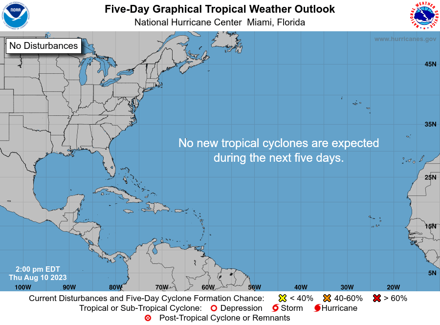
Latest (2 p.m.) NHC tropical weather discussion and graphic revision both now seem to support movement toward the southeast Big Bend solution -- and note formation chances are now 60% over two days, 80% over five:

ZCZC MIATWOAT ALL
TTAA00 KNHC DDHHMM

TROPICAL WEATHER OUTLOOK
NWS NATIONAL HURRICANE CENTER MIAMI FL
200 PM EDT SUN AUG 28 2016

For the North Atlantic...Caribbean Sea and the Gulf of Mexico:

The National Hurricane Center is issuing advisories on Hurricane
Gaston, located about 600 miles east of Bermuda, and on newly
formed Tropical Depression Eight, located about 400 miles southeast
of Cape Hatteras, North Carolina.

1. Shower and thunderstorm activity has begun to increase near and to
the east of a weak area of low pressure located just south of the
lower Florida Keys.  The low is expected to move westward into the
southeastern Gulf of Mexico on Monday, where environmental
conditions are expected to become more conducive for development,
and a tropical depression is likely to form within the next few
days.  This system is then expected to move slowly northward and
northeastward over the eastern Gulf of Mexico later this week.
Regardless of development, heavy rainfall and gusty winds are likely
to continue over portions of the northwestern Bahamas, central and
western Cuba, the Florida Keys and portions of southern Florida
through Monday.  Interests elsewhere in Florida and the eastern Gulf
of Mexico should continue to monitor the progress of this
disturbance.
* Formation chance through 48 hours...medium...60 percent
* Formation chance through 5 days...high...80 percent
The first worrisome storm of the season is now here - Page 12 Two_atl_5d0

dumpcare


Yea Bob why do you keep posting from storm2k?  After many of the posters on there are military meteorologist's, ex NHC and ones that have in the past almost early on with the formation of a system has a better track record than the NHC. Oh and one has in the past advised the NHC. Many of them are confused as the NHC right now although there is one on there that this morning called it just about where NHC is now projecting. Makes one wonder where the NHC gets their info. Yes and a good many of the poster's are crack pots or meteorologist students. Even Joe Bastardi posts on that board Bob and Mike Seidel said yesterday morning on Miami Beach that between the discussions and models there were 300 threads on that storm already.

Now that I'm done with that no one will know how strong it will get or where it will go until tomorrow night or Tuesday, maybe even not then. I will follow Joani's path.

Oh recon just flew in while I was typing and found ts winds but has not said if the circulation is closed or not.

dumpcare


https://www.ssec.wisc.edu/data/1min/index.php?action=view_animation&req_method=nframes_enddate&enddate=20160828&endtime=latest&nframes=80&band=1&res=1&aniwidth=1200&aniheight=700

Hospital Bob

Hospital Bob

RealLindaL wrote:

So why do you keep posting from storm2k, Bob???  They aren't the NHC, either, and I take them with a very large grain of salt.

On a separate question, in a post above you indicated that some "he" said the NHC stated this storm would not develop.  Who was that who said this?  I must've missed something.  And of course, the NHC has NOT said that at all, so I don't see how complete non-development could make Seaoat eat crow.  Call me confused --my usual state.


What can I say, I'm a hypocrite. lol

dumpcare


There is now a LLC may be updated at 5 or 1130 pm to td or possibly ts.

It will be going over the gulf loop the warmest waters in the gulf.

Looks like game on.

Product: NOAA Vortex Message (URNT12 KWBC)
Transmitted: 28th day of the month at 20:18Z
Agency: National Oceanic and Atmospheric Administration (NOAA)
Aircraft: Lockheed WP-3D Orion (Reg. Num. N43RF)
Mission Purpose: Investigate fourth suspect area (flight in the North Atlantic basin)
Mission Number: 5
Observation Number: 08
A. Time of Center Fix: 28th day of the month at 20:00:48Z
B. Center Fix Coordinates: 23°44'N 81°41'W (23.7333N 81.6833W)
B. Center Fix Location: 57 statute miles (93 km) to the S (174°) from Key West, FL, USA.
C. Minimum Height at Standard Level: Not Available
D. Estimated (by SFMR or visually) Maximum Surface Wind Inbound: 21kts (~ 24.2mph)
E. Location of the Estimated Maximum Surface Wind Inbound: 25 nautical miles (29 statute miles) to the WNW (296°) of center fix
F. Maximum Flight Level Wind Inbound: From 41° at 15kts (From the NE at ~ 17.3mph)
G. Location of Maximum Flight Level Wind Inbound: 26 nautical miles (30 statute miles) to the WNW (297°) of center fix
H. Minimum Sea Level Pressure: 1009mb (29.80 inHg) - Extrapolated
I. Maximum Flight Level Temp & Pressure Altitude Outside Eye: 27°C (81°F) at a pressure alt. of 306m (1,004ft)
J. Maximum Flight Level Temp & Pressure Altitude Inside Eye: 26°C (79°F) at a pressure alt. of 303m (994ft)
K. Dewpoint Temp (collected at same location as temp inside eye): 24°C (75°F)
K. Sea Surface Temp (collected at same location as temp inside eye): 29°C (84°F)
L. Eye Character: Not Available
M. Eye Shape: Not Available
N. Fix Determined By: Penetration, Wind and Pressure
N. Fix Level: Other - Not surface, 1500ft, 925mb, 850mb, 700mb, 500mb, 400mb, 300mb or 200mb
O. Navigational Fix Accuracy: 0.01 nautical miles
O. Meteorological Accuracy: 2 nautical miles

Remarks Section:
Sea Level Pressure Extrapolation From: 1,000 feet
Maximum Flight Level Outbound and Flight Level Wind: 29kts (~ 33.4mph) which was observed 33 nautical miles (38 statute miles) to the ESE (112°) from the flight level center at 20:10:16Z
Maximum Flight Level Temp: 27°C (81°F) which was observed 26 nautical miles (30 statute miles) to the WNW (297°) from the flight level cente

dumpcare


Yep it looks as though it will upgraded to TD9 in a just a few.

Hospital Bob

Hospital Bob

It'll be called Ian.  And believe it or not it already has 198 pages of posts on stormk2. And that's not the 99L threads either.  lol

dumpcare


They have been argueing about that a minute ago, it will only be named Ian if TD 8 hits TS strength first the experts say. I don't know.

You must be the new person posting from Pensacola lol.

RealLindaL


Bob wrote:
RealLindaL wrote:

So why do you keep posting from storm2k, Bob???  They aren't the NHC, either, and I take them with a very large grain of salt.

On a separate question, in a post above you indicated that some "he" said the NHC stated this storm would not develop.  Who was that who said this?  I must've missed something.  And of course, the NHC has NOT said that at all, so I don't see how complete non-development could make Seaoat eat crow.  Call me confused --my usual state.


What can I say,  I'm a hypocrite.  lol

lol!

(You didn't answer the second question, but that's OK.  Maybe I got that all wrong anyway, as usual.)

dumpcare


HWFI has this as a cat 5 on intesinty? does history repeat its self like the hurricane that hit Galveston?

Yes the 1900 storm. seems there are a lot of big storms that can intensify and come from this area.

These are from the boards.


Last edited by ppaca on 8/28/2016, 6:15 pm; edited 1 time in total

Hospital Bob

Hospital Bob

I'm not about to post to that board. If you can't talk like an expert they belittle you. Lol

dumpcare


Bob wrote:I'm not about to post to that board.  If you can't talk like an expert they belittle you. Lol

I figure it was probably Allen, Christian or Meg. Only some of them belittle you and then the moderator steps in. The guy who owns that needs donations to keep it online, it takes many servers and fully funded by donations.

Between the discussion thread and models it's been the most posted.

dumpcare


Just looking at the track and it's too early and depends on a trough turning it, although the supposed trough has not turned the wave up here by LA back this way and on satellite looks like there is heavy moisture that extends from the wave up here all the way down to TD9.

dumpcare


Navy research center agrees with the current path.

http://www.nrlmry.navy.mil/tc-bin/tc_home2.cgi?YEAR=2016&MO=08&BASIN=ATL&STORM_NAME=09L.NINE&PROD=track_vis&PHOT=yes&ARCHIVE=active&NAV=tc&AGE=Latest&SIZE=Thumb&STYLE=tables&AID_DIR=/SATPRODUCTS/TC/tc16/ATL/08L.EIGHT/tpw/microvap&TYPE=ssmi

dumpcare


Takes a while to load but this shows the wave off LA clearly coming back this way.

https://www.ssec.wisc.edu/data/1min/index.php?action=view_animation&req_method=nframes_enddate&enddate=20160828&endtime=latest&nframes=200&band=1&res=1&aniwidth=900&aniheight=1500

Hospital Bob

Hospital Bob

It all depends now on whether or not the weather systems developing have been reading storm2k and will obey the forecasts and move into position where they say they will. If not and that thing don't make the predicted northeast curve, then we could still be in the path of it. lol

Hospital Bob

Hospital Bob

Sometimes the dart throwers really can miss.
Case in point,  Hurricane Elena 1985.  Does anyone remember the goofy track that one took?  It was moving north in the Gulf straight towards us.
And then about 200 miles offshore it decides to take hard right turn and goes over to hover off the coast of Cedar Key.  We really breathed a sigh of relief here and counted our lucky stars.
That's when the son of a bitch decides to turn around and come right back to us again.
And none of that was forecast.

https://upload.wikimedia.org/wikipedia/commons/9/91/Elena_1985_track.png

dumpcare


Yes it all depends on the ULL coming back east towards us and the one coming down from TD8. Nine is currently a little WSW, is it slowly creeps that way the ULL's are out of the picture and the whole gulf coast is open for landfall.

dumpcare


Bob you think the Canadian model has anything to it?

http://www.tropicaltidbits.com/analysis/models/?model=gem&region=09L&pkg=mslp_wind&runtime=2016082812&fh=102&xpos=0&ypos=114

2seaoat


I'm not about to post to that board. If you can't talk like an expert they belittle you. Lol


Now when has that stopped you?

Sponsored content


Back to top  Message [Page 12 of 26]

Go to page : Previous  1 ... 7 ... 11, 12, 13 ... 19 ... 26  Next

Permissions in this forum:
You cannot reply to topics in this forum